Demonstration site: Application of BIM-speed tools in Berlin, Lichtenrade

Demonstration site: Application of BIM-speed tools in Berlin, Lichtenrade
The BIM-SPEED project aims to offer solutions for smarter and more efficient methods of deep renovation for the residential building sector. However, we believe there is no better way to develop solutions than to test them in practice. Therefore, BIM-SPEED is testing its solutions in 13 real demonstration cases that cover all of Europe’s climatic geo-clusters and varying levels of BIM experience in different countries. Today we highlight the Lichtenrade demonstration site in Berlin, Germany.
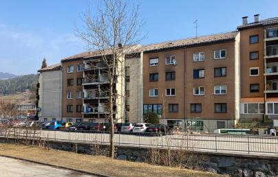
The Lichtenrade site contains multistory, multifamily residential buildings. Two BIM-SPEED tools have been implemented and tested:
- GIS Data Provider Service: for retrieving geospatial data in the surrounding of any specific demonstration site (at the moment, the service provides data only for Berlin city)
- MEREEN Weather service: for retrieving recent ‘actual’ weather data for any specific demonstration site
The tools retrieve datasets from the surroundings and the environment and help improve the renovation workflow. These tools can be used for different use cases, including site planning, building energy modeling, acoustic comfort analysis, air quality comfort analysis, thermal comfort analysis, and lighting comfort analysis.
To implement the GIS data provider service on the Berlin demonstration site, BIM-SPEED selected a site planning use case. The GIS Data Provider retrieves geospatial data layers from the demonstration site by extracting the GPS location of the IFC file of the building. These data layers can be beneficial or are required for site planning. The retrieved data can be downloaded in shapefile format and visualized in GIS software such as ArcMap.
During the data collection phase at the Berlin Lichtenrade site, certain limitations of using drones for 3D and thermal scanning of the building came to light. The GIS data showed that the façade of the building is covered by trees. It also showed that an airport is close to the building. Both limit the possibility of drone flight. Additionally, the GIS data revealed that the building is surrounded by railway and roads. Therefore, the acoustic comfort of the building is considered in the renovation process. The GIS data layers also uncovered historical buildings close to the demonstration site, leading to proposals to check the regulation for the construction.
The MEREEN weather service retrieves ‘actual’ weather data from 2005 to 2020 for the Berlin demonstration site. The data is automatically extracted from the GPS location of the IFC file of the building. The single years weather data can be used in the calibration process of the building energy model. Additionally, the single years data and long-term ‘actual’ weather data can also be used for running building energy models in the building design process. The initial investigation of the Lichtenrade site, using long-term actual weather data, showed significant energy consumption reduction in the building compared to the old TMY datasets provided by EnergyPlus.
Both GIS Data Provider Service and MEREEN Weather service are a part of BIM-SPEED Deliverable 1.4, additional information and maps will be a part of the D1.4 report.

